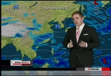
for thursday, though, beijing, minus 2 for the high. ulan bator, very chilly for you. 30s across thailand and philippines, seeing isolated afternoon pop-up thunderstorms as well, especially in evening hours as well. as we take a look into the americas, we have a low-pressure area starting to pull off toward the northeast. this is going to be creating all sorts of messy travel weather conditions throughout the next several days across the next central plains to the western great lakes. this low, see the lines really close together just off toward the north? it's indicating some 80 kilometer per hour winds, kicking up heavy snowfall, adding up to 30 centimeters, the storm continues to march toward the east and then toward the south, you have warm air and moisture inflow coming in. erupting the rick of severe weather. fast-moving storms from the west toward the east here. throughout your day on your wednesday evening, even into thursday as well. and coming by very gusty winds and heavy rainfall. the good news, doesn't look like the storms
 Live Music Archive
 Librivox Free Audio
 Metropolitan Museum
 Cleveland Museum of Art
 Internet Arcade
 Console Living Room
 Books to Borrow
 Open Library
 TV News
 Understanding 9/11